The City of Pittsfield is permitted to conduct a 2ft drawdown of Onota Lake, to occur between October 15 and December 1 each year. The lake must be refilled by the following April 1 if possible.
Additional requirements and restrictions govern the drawdown and refilling of the lake, as contained Order of Conditions approved by the Pittsfield Conservation Commission in 2020, including some required approvals by the Natural Heritage and Endangered Species Program of the Massachusetts Division of Fish and Wildlife (NHESP).
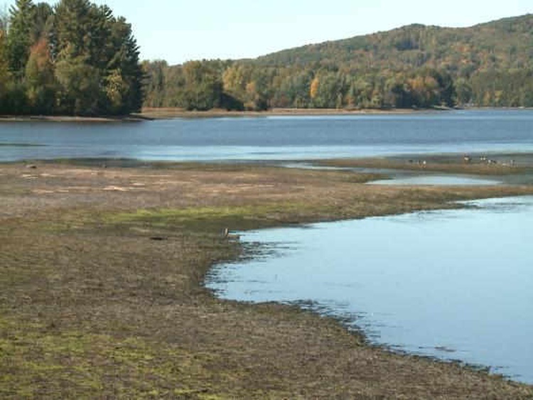
In 2019 there was no drawdown of the Onota Lake, due to the City’s concerns about interference the Mill Street Dam removal, and additional concerns about regulatory compliance. As a result, the shores of the lake incurred significant ice damage, as documented in a LOPA report. In 2020, the NHESP approved only a restricted 1ft drawdown, while awaiting a survey for a particular rare and endangered plant species to be conducted in 2021. Fortunately, a quick spring ice-out in 2021 curtailed damage to the shoreline.
Before 2019, an annual drawdown of 3ft typically was utilized at Onota Lake to protect against flooding during spring runoff, to prevent shoreline damage from ice, and to provide limited control of aquatic invasive species.
The switch to the present restricted 2ft drawdown was at the instigation of the Massachusetts Department of Environmental Protection (MassDEP), and reflects “suggested conditions” that MassDEP prepared as guidance for the City and the Conservation Commission.
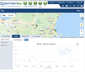
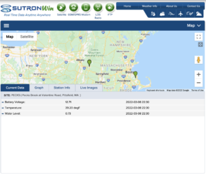 To access the real time water elevation of Onota Lake as measured at the Onota Lake Dam, please click on this link: